February 23, 2015--Lines In the Sand
At the end of the First World War, a territorial plan devised by Sir Mark Sykes of Great Britain and Francois Georges-Picot of France established spheres of influence in the Middle East for the victorious European powers. Some compared this to drawing lines in the sand.
Prior to the War, most parts of the region were under the control of the Ottoman Empire. This included all of present-day Turkey, much of North Africa, and virtually all of the Middle East with the notable exceptions of Arabia, today's Saudi Arabia, and Persia, today's Iran.
The Syke's-Picot secret agreement became the blueprint for the dismemberment of the Ottoman Empire after its defeat in the War-to-End-All-Wars. The Great Powers, particularly France and Britain, with the assent of Russia, carved up the former Ottoman territory, creating modern Turkey and the countries that make up the contemporary Middle East, and assigned to themselves mandates and colonial oversight for what became Iraq, Jordan, Syria, and Palestine among other newly established countries.
(The U.S. President Woodrow Wilson was more interested in the establishment of the League of Nations and so effectively kept hands off as the region was carved up and parceled out.)

Based on Sykes-Picot, the Treaty of Paris assigned the blue regions to French authority, the red to British, and the green to Russian.
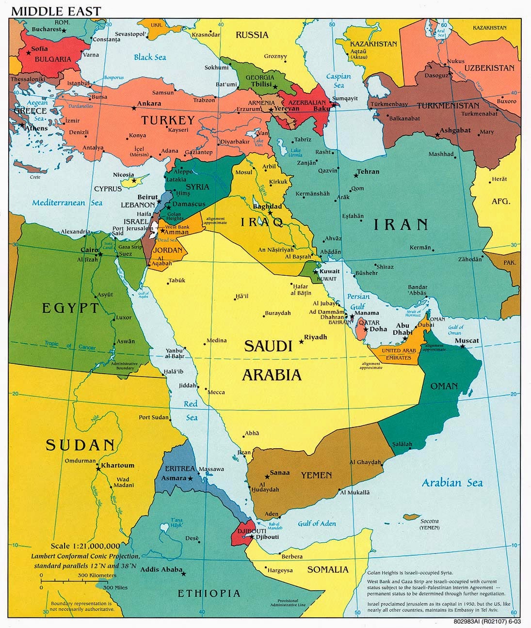
The more delineated map of the Middle East which was derived from the Sykes-Picot accord is the one we live with today. Take special note of those countries that were assigned straight-line borders. It is particularly revealing that some of the countries that are most in turmoil and include restive populations, jihadists, and other groups of terrorists, are those with these kind of linear borders that do not take geography, culture, or religion into consideration--Syria, Sudan, Egypt, Yemen, Lebanon, Jordan, Iraq, and of course Israel.
Thus, "Iraq" should probably be deconstructed into at least three countries with cultural borders, including Kurdistan, and "Libya" into at least that many. The region, and the world would be much more peaceful if those who met in Paris in 1919 would have established borders that took history, religion, and tribal identity into consideration.
One might counter that there are straight line borders in the United States. Many. In fact, two of our states are virtual rectangles (Colorado and Wyoming), and four meet at the Four Corners (Colorado, Utah, Arizona, and New Mexico), but with the exception of the genocidal example of what we did to our Native populations, territories that became states were not that culturally diverse and applied for statehood, staking out and suggesting their own borders. These borders for the most part were as viable as others that used rivers and mountain ranges as natural ways to divide and assign territory.

Prior to the War, most parts of the region were under the control of the Ottoman Empire. This included all of present-day Turkey, much of North Africa, and virtually all of the Middle East with the notable exceptions of Arabia, today's Saudi Arabia, and Persia, today's Iran.
The Syke's-Picot secret agreement became the blueprint for the dismemberment of the Ottoman Empire after its defeat in the War-to-End-All-Wars. The Great Powers, particularly France and Britain, with the assent of Russia, carved up the former Ottoman territory, creating modern Turkey and the countries that make up the contemporary Middle East, and assigned to themselves mandates and colonial oversight for what became Iraq, Jordan, Syria, and Palestine among other newly established countries.
(The U.S. President Woodrow Wilson was more interested in the establishment of the League of Nations and so effectively kept hands off as the region was carved up and parceled out.)
Based on Sykes-Picot, the Treaty of Paris assigned the blue regions to French authority, the red to British, and the green to Russian.
The more delineated map of the Middle East which was derived from the Sykes-Picot accord is the one we live with today. Take special note of those countries that were assigned straight-line borders. It is particularly revealing that some of the countries that are most in turmoil and include restive populations, jihadists, and other groups of terrorists, are those with these kind of linear borders that do not take geography, culture, or religion into consideration--Syria, Sudan, Egypt, Yemen, Lebanon, Jordan, Iraq, and of course Israel.
Thus, "Iraq" should probably be deconstructed into at least three countries with cultural borders, including Kurdistan, and "Libya" into at least that many. The region, and the world would be much more peaceful if those who met in Paris in 1919 would have established borders that took history, religion, and tribal identity into consideration.
One might counter that there are straight line borders in the United States. Many. In fact, two of our states are virtual rectangles (Colorado and Wyoming), and four meet at the Four Corners (Colorado, Utah, Arizona, and New Mexico), but with the exception of the genocidal example of what we did to our Native populations, territories that became states were not that culturally diverse and applied for statehood, staking out and suggesting their own borders. These borders for the most part were as viable as others that used rivers and mountain ranges as natural ways to divide and assign territory.
Labels: 1919 Treaty of Paris, Great Powers, Iran, League of Nations, Middle East, Ottoman Empire, Palestine, Political Geography, Saudi Arabia, Sykes-Picot, Turkey, U.S. Geography, Woodrow Wilson, World War I
posted by Steven Zwerling at
5:33 AM
![]()
![]()


0 Comments:
Post a Comment
Subscribe to Post Comments [Atom]
<< Home